


Description
Subsea Survey, Systems Positioning and Metrology (SSSPM) Level 1 & Level 2 equip participants with the fundamental understanding and practical expertise required to carry out accurate and precise measurements and positioning in the subsea industry.
SSSPM Level 1 Course:
Introduction to Subsea Surveying: Participants are introduced to the field of subsea surveying and its importance in various subsea operations. The course covers the basic principles, methods, and equipment used in subsea surveying, including sonar systems, acoustic positioning, and multibeam echo sounders.
Subsea Positioning Systems: This section focuses on the different positioning systems used in subsea operations. Participants learn about global navigation satellite systems (GNSS), inertial navigation systems (INS), and other advanced positioning technologies. The course covers their principles, limitations, and integration with other surveying equipment.
Data Acquisition and Processing: Participants gain insights into data acquisition techniques for subsea surveys, including data collection, processing, and quality control. The course covers the use of software tools for data management, editing, and analysis in subsea surveying projects.
Subsea Metrology: This module introduces participants to the principles and methods of subsea metrology, which involves precise measurements and alignment of subsea structures and equipment. Participants learn about measurement techniques, instruments, and analysis methods specific to subsea metrology tasks.
Health, Safety, and Environment (HSE) Considerations: This section focuses on the importance of health, safety, and environmental practices in subsea surveying operations. Participants gain an understanding of risk assessment, emergency procedures, and safety regulations specific to subsea environments.
SSSPM Level 2 Course:
The Level 2 course builds upon the knowledge gained in Level 1 and delves deeper into advanced topics and practical applications. The course may include:
Advanced Subsea Survey Techniques: Participants explore advanced survey techniques used in subsea environments, such as side-scan sonar, sub-bottom profiling, and laser scanning. The course covers their applications, data processing methods, and integration with positioning systems.
Subsea Positioning for Construction and Installation: This section focuses on positioning techniques and methodologies for construction and installation activities in subsea projects. Participants learn about dynamic positioning, real-time kinematic (RTK) positioning, and geodetic surveying in the context of subsea operations.
Subsea Metrology for Asset Integrity: Participants gain insights into subsea metrology techniques used for asset integrity management. The course covers techniques for monitoring structural deformation, corrosion assessment, and measurement of critical dimensions in subsea infrastructure.
Case Studies and Practical Exercises: The course may include case studies and practical exercises to apply the learned concepts and enhance problem-solving skills. Participants analyze real-world scenarios, carry out subsea surveying tasks, and interpret and present survey data.
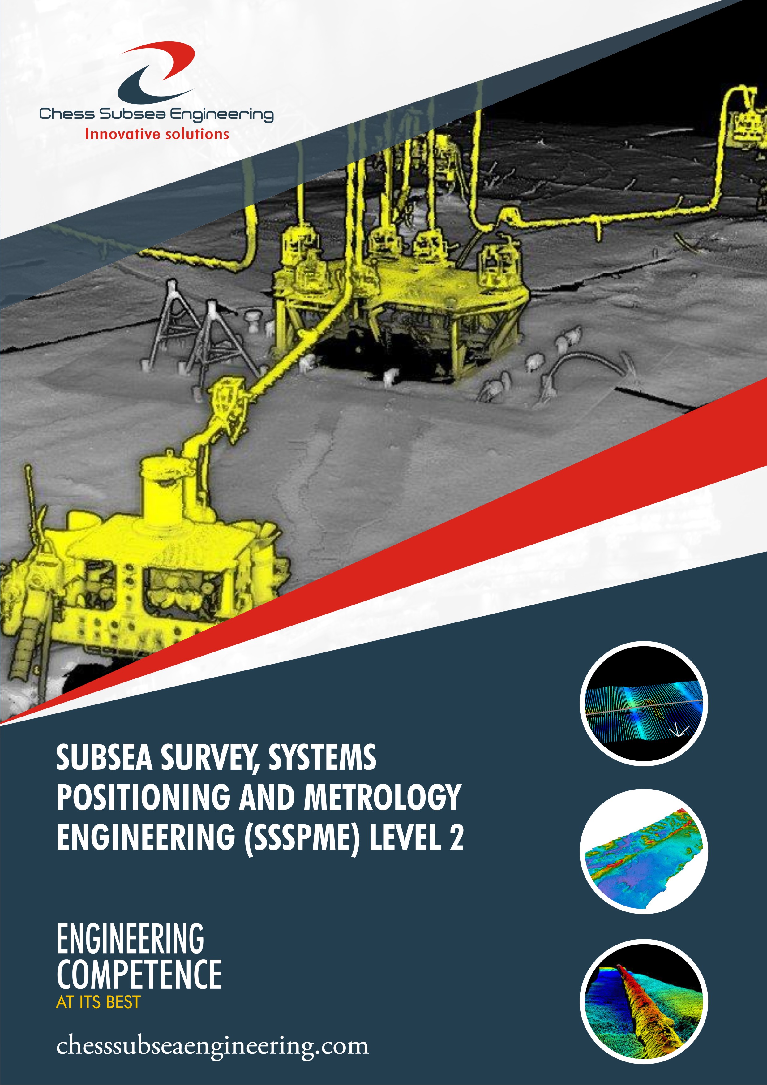
Subsea Survey, Systems Positioning and Metrology (SSSPM) Level 1 & Level 2 covers Subsea Survey, Geotechnical & Geophysical Site Investigation, Subsea Systems Positioning Techniques, Types of Subsea Systems Positioning sensors i.e. USBL, LBL & SBL , Acoustic Positioning Systems, Application of acoustic positioning systems i.e. Installation & Subsea Metrology Case Studies, Accuracy & Repeatability and more.
Course Outline
Importance of surveying in subsea operations
Basic surveying principles and techniques
Overview of subsea surveying equipment and technologies
Global Navigation Satellite Systems (GNSS) and their application in subsea positioning
Inertial Navigation Systems (INS) for subsea operations
Introduction to acoustic positioning and multibeam echo sounders
Data collection methods in subsea surveying
Processing and quality control of subsea survey data
Introduction to software tools for data management and analysis
Principles and methods of subsea metrology
Measurement techniques and instruments used in subsea metrology
Analysis and interpretation of subsea metrology data
Importance of HSE practices in subsea surveying
Risk assessment and safety regulations specific to subsea environments
Emergency procedures and protocols
Side-scan sonar and its applications in subsea surveys
Sub-bottom profiling for seabed mapping and geological studies
Laser scanning for detailed subsea asset mapping and inspection
Dynamic positioning systems in subsea construction and installation activities
Real-Time Kinematic (RTK) positioning techniques for precise subsea positioning
Geodetic surveying methods for accurate subsea measurements
Monitoring structural integrity and deformation using subsea metrology techniques
Corrosion assessment and measurement in subsea infrastructure
Measurement of critical dimensions for asset integrity management
Analysis of real-world case studies in subsea surveying, positioning, and metrology
Interpretation and presentation of survey data
Additional Technical Support Sectional References
Ref 1: Subsea Survey, Positioning & Metrology and Offshore Installation and Vessels
Ref 2: Geotechnical & Geophysical Site Investigation
Ref 3: Surface & Subsea Systems Positioning Techniques
Ref 4: Subsea Acoustic Positioning Systems
Ref 5: Subsea Metrology
Ref 6: Subsea Metrology Deliverables
Ref 7: Dimensional Control Requirements for Metrology
Ref 8: Spool Piece Metrology with Case Study
Ref 9: Calibration of Short Baseline System Steps
Ref 10: Calibration of Long Baseline System Steps
Ref 11: Calibration of Ultra Short Baseline System Steps
Ref 12: Differences between Transmitters and Transducers
Ref 13: Inertial Acoustic Metrology
Ref 14: Inertial Measurent Unit IMU working principle
Ref 15: Subsea Positioning and Navigation
Ref 16: Metrology & Remote Offshore Survey
Ref 17: Offshore Seabed Resistivity Systems
Ref 18: Offshore Marine Resistivity & Measurement Steps
Ref 19: USBL & Underwater Positioning
Ref 20: Subsea Pipelines Tie Ins Spool Fabrication and Installation with USBL Case Study
Ref 21: Global Navigation Satellite System (GNSS)
Ref 22: Long Baseline (LBL) Acoustic Positioning & Steps
Ref 23: Short Baseline (SBL) Acoustic Positioning & Steps
Ref 24: Ultra Short Baseline (USBL) Acoustic Positioning & Steps
Ref 25: Inertial Navigation System (INS)
Ref 26: Terrestrial Laser Scanning Positioning Techniques & Steps
Ref 27: Photogrammetry Positioning Techniques & Steps
Assessment
Participant underpinning knowledge of subsea survey, systems positioning and metrology will be accessed with short answer multiple-choice questionnaire at the conclusion of the course.
Outcome
Participants will gain an in debt understanding of Subsea Survey, Systems Positioning & Metrology Engineering. They will also be able to function with minimum supervision as a Subsea Engineer or Subsea Survey Engineer for IOCs, subsea pipeline company contractor, vendor or installation company.
Professional Certificate
Issued directly by Chess Subsea Engineering Europe.
Participant may be presented for Offshore Petroleum Training Organization (OPITO) Certification.
How to Register
Click here to download registeration booklet on msword and email completed booklet to info@chesssubseaengineering.org directly.